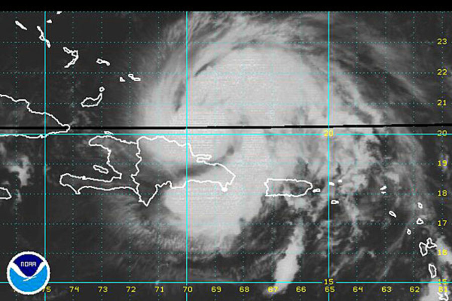
Hurricane Irene getting bigger, stronger
Loading...
| SANTO DOMINGO
Hurricane Irene was expected to strengthen over the next few days and could hit the southeastern United States as a large and powerful storm late in the week, forecasters said Tuesday.
The U.S. National Hurricane Center's forecast indicated Irene, now classified as a Category 2 storm, may become a major Category 3 storm, with winds over 111 mph, before hitting the southeast U.S. coast by the weekend.
The first hurricane of the 2011 Atlantic season, which was as large as it was intense, was expected to swing parallel to Florida's east coast Thursday for a possible landfall in North or South Carolina Saturday.
Irene, the ninth named storm of the busy 2011 Atlantic season, looks set to be the first hurricane to hit the United States since Ike savaged the Texas coast in 2008.
The storm's core was expected to pass north of the Dominican Republic and Haiti early Tuesday and the southeastern Bahamas by late in the day. It was moving to the west-northest at 12 mph. Hurricane-force winds extended outward from the core to 50 miles and tropical storm-force winds extended out up to 205 miles.
The storm could be the catalyst the insurance industry has been seeking in its quest for across-the-board premium increases, in what already promises to be the costliest year in history for natural disasters around the globe.
Authorities along the U.S. Atlantic seaboard, from Miami to New York, were closely watching Irene's possible path, with at least some computer forecast models showing it might even sweep up near New York City early next week.
President Barack Obama was briefed about Irene while on vacation at the Massachusetts island of Martha's Vineyard, White House officials said.
At 5 a.m. EDT Irene had top winds of 100 miles per hour and was 50 miles northeast of Puerto Plata, Dominican Republic.
'NON-EVENT' IN DOMINICAN REPUBLIC
The storm seemed to have spared the economically important tourist area of Punta Cana as it passed by earlier in the day.
``It was a non-event. ... It was kind of just of rainy day, it could have been a lot worse,'' Mike Bryant, who runs a small adventure tourism company at Punta Cana, told Reuters.
Earlier, Irene buffeted Puerto Rico with winds and heavy rain, knocking out power and downing trees.
In Haiti there were fears that rain from Irene could trigger deadly floods and mudslides in a country still struggling to recover from a devastating 2010 earthquake.
Forecasters said a low pressure trough over the eastern United States was expected to keep Irene's track to the east, reducing the risk of a direct hit to densely populated south Florida, and steering it instead to the Carolinas.
While the core of the storm was expected to stay out to sea as it moved past Florida, Irene was wide enough for its outer squalls to reach the Florida shore.
Forecasts showed Irene posing no threat to U.S. oil and gas installations in the Gulf of Mexico.
There were no reports of deaths or major injuries in Puerto Rico but 800,000 people -- half of the island's electricity customers -- were left without power by the storm, which felled trees, swelled rivers over their banks and flooded some roads.
Governor Luis Fortuno said the worst-hit area was the east coast, from Fajardo to Yabucoa, and he had asked the U.S. government to declare Puerto Rico a disaster area so it can gain access to emergency funds.
(Additional reporting by Alister Bull in Vineyard Haven, Mass.; Reuters in San Juan; Tom Brown and Jane Sutton in Miami, Ben Berkowitz in New York; Writing by Pascal Fletcher; Editing by Todd Eastham)


