How an Arizona glaciologist helped tease out effects of Nepal quake
Loading...
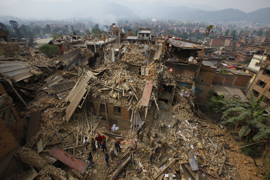
The April 25 earthquake in Nepal was devastating: more than 8,500 people died, making it the deadliest disaster in Nepal’s history. But a team of scientists from the University of Arizona published a study in the journal Science Wednesday that suggests the 7.8 magnitude earthquake could have been much worse by triggering numerous landslides.
After the quake struck Nepal the lead author of the report, Jeffrey Kargel, wanted to use his resources as a senior associate research scientist in the University of Arizona's Department of Hydrology and Water Resources to help Nepal from 8,000 miles away.
“For the first 24 hours after the quake, I was beside myself suffering for my friends and the country of Nepal that I so love,” Dr. Kargel said in a press release. “I thought, what can I do? I’m sitting here in Tucson – how can I help Nepal?”
Using his expertise in satellite imaging and his colleagues in the Global Land Ice Measurements from Space (GLIMS), Kargel realized he could analyze the earthquake’s effect on Himalayan glaciers and potential post-quake landslides.
Kargel and GLIMS scientists from around the world worked with the NASA Applied Sciences Disasters group to analyze satellite images of the region and identify areas of need. And the scientists were surprised at what they found.
“There were a lot of surprises,” Kargel told BBC News. “The nature of the earthquakes’ influence on the landscape, from the largest scales to the smaller scales, was not really as we would have expected.”
Some 4,312 landslides occurred within the six weeks after the quake. While this may sounds like a lot, scientists say its far fewer than what have occurred after quakes of similar magnitude in similar, mountainous regions.
And after analyzing similarities between the 4,312 landslides, Kargel and his team found a pattern that was “unexpected and hadn’t been observed before.” During an earthquake, humans feel shaking because the terrain rises and falls. The majority of documented landslides occurred in places where the ground surface dropped down, instead of areas where the ground surface rose up.
The scientists also concluded from their research that overall shaking during the Gorkha earthquake was minimal compared to other earthquakes of similar magnitude, thus contributing to less landslides.
“All kinds of Earth processes can cause a landslide,” said Kargel. “The Gorkha earthquake observations add to our understanding of landslides around the world.”
But Kargel notes that the lack of landslides shouldn’t undermine the gravity of the earthquake’s impact on the South Asian country.
“It was a really bad earthquake – over 9,000 fatalities in four countries,” he said in the press release. “As horrific as this was, the situation could have been far worse for an earthquake of this magnitude.”
And even after a natural disaster that caused thousands of casualties, Kargel is inspired by the international collaboration between scientists immediately after the quake.
The research was possible because of contributions from scientists around the world who volunteered their time and worked long-hours after the quake, analyzing data images of satellite data and mapping future hazards. Some 58 other scientists from over 35 institutions throughout 12 countries worked alongside Kargel to develop this report.


