How smart phones could bring early earthquake detection to developing world
Loading...
A smart phone sensing the first weak tremors from a nearby earthquake to warn that strong shaking is on its way? Yep, they're planning an app for that.
A team of geophysicists has found that a modest collection of smart phones capable of using data from navigation satellites has the potential to serve as a cheap early-warning network for large earthquakes.
The proof-of-concept analysis found that a network of smart phones comparable to an LG Google Nexus 5 also can deliver accurate measurements of an earthquake's strength and quickly pinpoint the epicenter.
In practice, the concept could bring early warnings to millions of people who would otherwise be caught off guard. Such a system could be especially valuable for developing nations with limited resources to invest in state-of-the-art seismology equipment.
The goal is not to find a cheaper replacement for existing, dense networks that use science-grade monitoring equipment, notes Benjamin Brooks, a geophysicist with the US Geological Survey office in Menlo Park, Calif., and a member of the research team. These networks detect a broader range of potentially damaging quake magnitudes than smart phones can, at least as the phones currently are configured.
But only eight relatively small regions around the globe use high-end networks for early warning. These networks use seismometers, which measure ground motion, or seismometers combined with global-positioning satellite data. Each installation in a network can cost between $20,000 and $30,000. Not every country facing a high risk of powerful earthquakes can afford such systems.
Smart phones, on the other hand, are ubiquitous and are becoming more so. They tend to include GPS receivers as well as accelerometers to sense motion. More than 1 billion are in pockets and purses around the world, with the number expected to rise to nearly 6 billion by 2020.
The goal is to explore the potential of smart-phone earthquake early-warning networks with an eye toward deploying them in in countries that may not be able to afford science-grade monitoring stations. Of primary concern are countries located near boundaries between shifting plates of Earth's crust, especially subduction zones, where one plate slides beneath another plate. These zones generate the planet's most powerful quakes.
The potential is intriguing enough to have prompted the US Agency for International Development (USAID) to provide the team with a $500,000 grant for a demonstration project in Chile, which frequently is rocked by strong earthquakes. It also has endured the most powerful earthquake on record, a magnitude 9.5 quake that struck just south of the coastal city of Concepción in 1960.
The demonstration project will employ 200 to 250 smart phone-based sensors in various Chilean buildings. These will operate alongside a science-grade network the country also is installing.
The idea to enlist smart phones for earthquake early-warning systems grew out of work researchers had been conducting with laptop or desktop computers as the sensing devices, Mr. Brooks explains. Laptops often have accelerometers for sensing motion as a trigger to lock down a hard drive in case the laptop is dropped.
For the current study, published Friday in the open-access, online journal Science Advances, the team first determined if a smart phone was up to the task. They measured the random background noise in the device's data, then subjected it to controlled amounts of shaking to gauge its response.
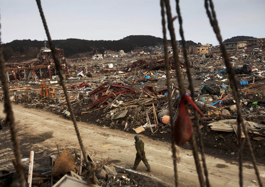
Then the team conducted two simulations, one involving a hypothetical magnitude 7 earthquake along the Hayward Fault, which runs along the western edge of the Berkeley Hills on the east side of San Francisco Bay. They also tested the approach using real seismic and GPS data from the 2011 Tohoku-Oki earthquake. At magnitude 9, it was the most powerful earthquake on record for Japan and the fourth most powerful globally.
Assuming only a small number of potentially available smart phones would be active at any moment, the team found that phones representing 0.2 percent of the study area's population – about 4,700 people – could trigger an alert for the Hayward quake within five seconds of its onset. That would represent a few seconds' warning time for San Francisco and tens of seconds for San Jose that major shaking was on its way.
For Tohoku, as few as 510 phones would have triggered an alert 77 seconds after the quake ruptured. This would not have left enough time to warn coastal areas closest to the offshore epicenter of impending shaking. But it would have allowed for a tsunami warning several minutes before the wave struck. And it would have given Tokyo up to 10 seconds' warning.
To be sure, the lead times are short. But they are long enough to place aircraft on hold on the ground or in the air, give people time to take cover, close tunnels and bridges, and move away from hazardous machines or materials in the workplace.
With a field project in Chile under way, the team already is looking ahead to other sources of crowd-sourced earthquake early-warning data.
"We used smart phones because they are so prevalent," Brooks says. Another "monitoring station" ripe for exploration: vehicles.
"Every new vehicle, especially as we get to robotic vehicles, will have GPS as a fundamental part of its very operation. Those are sitting outside, usually. They are beautiful geodetic sensors."


