Hurricane forecast was way off last year. What does it say this year?
Loading...
The 2014 Atlantic hurricane season is shaping up to be a mild one, according to forecasters with the National Oceanic and Atmospheric Administration's Climate Prediction Center (CPC).
It's one of several seasonal hurricane forecasts anticipating a relatively quiet year.
The CPC's outlook calls for eight to 13 tropical storms during the upcoming season, which begins June 1 and ends Nov. 30. Out of those storms, three to six are expected to form hurricanes. Of the hurricanes that form, one or two are expected to become major hurricanes – storms whose highest sustained winds exceed 111 miles an hour.
Overall, the CPC gives the season's activity a 50 percent chance of falling below the 1981-2010 average and a 40 percent chance of reaching that average of 12 named storms, 6.5 hurricanes, and two major hurricanes.
A below-average season, however, doesn't mean the US Gulf and East Coasts can breathe easy. The 1992 hurricane season produced only seven named storms. But one of them was hurricane Andrew, which struck south Florida as a Category 5 storm – the most powerful category – and later the Louisiana coast near Morgan City as a Category 3. Andrew inflicted more the $26 billion in damage and claimed 74 lives along its path.
"No percentage number, no probability number high or low, erases the fact that the real message is: We're starting into hurricane season; any section of our coastline can be hit with a severe tropical storm; and whatever the probabilities are, one storm can wreak tremendous havoc," said Kathryn Sullivan, NOAA's administrator, during a briefing Thursday unveiling the forecast.
Last year's troublesome forecast
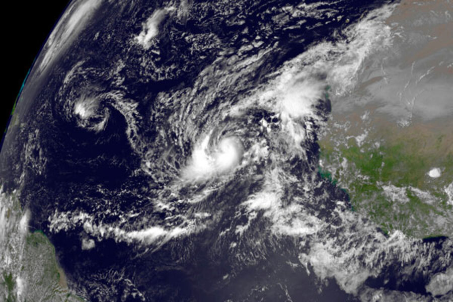
Indeed, seasonal forecasting is a dicey activity. Last year, the consensus among among prominent forecasting teams held that the Atlantic hurricane season would be more active than normal. From the standpoint of hurricanes, it wasn't.
The forecasts that looked the worst at season's end supplied a single number for named storms, hurricanes, and major hurricanes. Others, such as the CPC, a forecasting group at North Carolina State University, and another at Florida State University provided ranges, better reflecting the uncertainties inherent in the forecasts. Thirteen storms grew strong enough to earn a name, a total that fell at the bottom of the ranges these three offered.
Several forecasts anticipated eight or nine hurricanes. No forecast, however, foresaw fewer than five. Two formed. And the season saw no major hurricanes, where several seasonal forecasts envisioned three or more.
The gap between forecast and what nature delivered triggered some intense forensics work to figure out what happened, according to Jerry Bell, a research meteorologist at the CPC and the lead forecaster for seasonal hurricane outlooks.
"I spent many months looking back at last season, trying to figure out why the forecasts overpredicted" and trying identify the conditions that kept a lid on the number of hurricanes.
Typically, a season's activity is dominated by a handful of seasonal climate patterns "that are so strong, they typically win out" over other, harder-to-predict factors that can affect hurricane formation, Dr. Bell says.
The broad factors range from sea-surface temperatures in the tropical Atlantic to the long climatological reach of changes in the east-west distribution of warm surface waters in the tropical Pacific. These factors pointed to an active season.
What went wrong
Last year, however, the climate system through forecasters a curve. "A very rare, persistent jet stream pattern of record strength locked in," Bell explains. The pattern in this planet-circling, meandering high-altitude river of air, which steers storm systems as it travels from west to east, produced the bane of hurricanes: wind shear.
Wind shear is a change in wind speed or direction with altitude. It stunts the organization and growth needed to turn a ragged collection of thunderstorms into a single tropical cyclone or to turn a tropical storm into a hurricane. In addition, conditions led large parcels of air to sink over the tropical Atlantic, counteracting the tendency of warm, moist air at the surface to rise sufficiently to build or maintain a storm.
Such conditions have occurred only twice since 1970, with last year the second instance, Bell says.
Others scientists, such as Colorado State University's Philip Klotzbach and William Gray, who pioneered seasonal hurricane forecasts, have proposed that the dearth of hurricanes in 2013 occurred because a large-scale ocean current in the North Atlantic known as the Atlantic Ocean Thermohaline Circulation weakened during the prior winter and spring. The weakening allowed cooler northern waters to migrate farther south than they otherwise would have.
What's driving this year's forecast
This year's forecasts for below-average activity are driven by several observations.
Warmer-than-normal surface water is extending its reach from the western tropical Pacific to the west coast of South America – a feature known as El Niño, the warm half of one of the most influential natural cycles in Earth's climate system.
El Niños tend to appear every three to seven years, on average, bringing with them an increase in the intensity of wind shear over the tropical Atlantic. During its opposite, La Niña, shear weakens, which favors tropical-cyclone formation. Forecasters are predicting the onset of El Niño this summer and fall, although it remains unclear how strong it will be.
In addition, sea-surface temperatures in the main storm-forming region have cooled n recent months. This could lead to a lower-octane fuel for the storms, which draw energy from warm surface waters.
In their April forecast, Drs. Klotzbach and Gray anticipate nine named storms, three hurricanes, and one major hurricane. They anticipate releasing an updated forecast June 2.
A forecasting team at North Carolina State University, which also published its forecast in April, expects the season to deliver eight to 11 named storms, four to six hurricanes, and one to three major hurricanes.
Florida State's group is expected to release its seasonal forecast May 30.
Starting June 1, nature will again be the arbiter.


