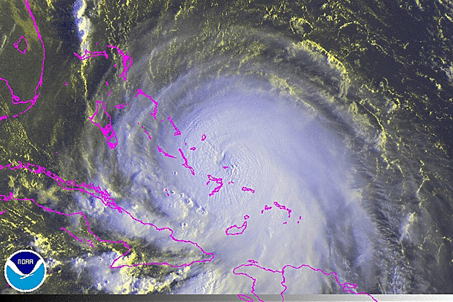
Hurricane Joaquin: How to be prepared
Loading...
A powerful hurricane has made landfall in the Bahamas, hammering the islands with torrential rain, flooding, and powerful winds.
Hurricane Joaquin is threatening to head straight northward to the east coast of the United States. By Thursday afternoon it had intensified, with maximum sustained winds of 130 miles per hour, pushing it to a Category 4 storm, the National Hurricane Center said.
At the moment, Joaquin’s forecast track shows it could be near North Carolina by Monday and possibly New Jersey a day later – a path so close to that of 2012's Superstorm Sandy that claimed lives and caused property damage worth billions of dollars. In anticipation of Joaquin, New Jersey Gov. Chris Christie Thursday issued a state of emergency.
It's however not yet clear what threat Joaquin poses to the East Coast as projections have changed multiple times in recent days.
“A complicated atmospheric pattern has made Joaquin particularly difficult to track, according to Weather Channel forecasters, who said it was too soon to determine what impact Joaquin could have on the US East Coast starting this weekend,” The Christian Science Monitor reports.
But whether it makes a landfall or not, Joaquin is expected to produce significant rainfall for the East Coast.
“One way or the other, North Carolina, South Carolina, Virginia and on up will get between 5 and 10 inches of rain — even without a direct landfall,” CNN meteorologist Chad Myers said. “If we get a landfall, we get 15 inches of rain and winds of 80 mph."
“But without even a direct landfall, there will be significant flooding through the Carolinas, through Virginia, and all the way up the East Coast,” he added.
When a hurricane rolls in, heavy rainfall and inland flooding, storm tide, high winds, rip currents and tornadoes can be a dangerous threat. So, how can one prepare and survive a hurricane?
The Federal Emergency Management Agency (FEMA) offers several recommendations:
- First, know the difference between a hurricane watch and a hurricane warning. A hurricane watch means that hurricane conditions are possible within the next 48 hours. A hurricane warning means that hurricane conditions are expected within the next 36 hours.
- Don’t get caught by dangerous flood waters. Historically, most hurricane deaths and damages aren’t because of winds – they happen because of flooding.
- Don't drive through flooded roads! A mere six inches of fast-moving flood water can knock over an adult. It only takes two feet of rushing water to carry away most vehicles, including pickups and SUVs.
- Have a plan for bringing in all outdoor furniture and securing anything else that isn’t tied down, should a storm threaten the area.
- Bring in outdoor furniture and anything else that is not tied down to prevent injury/damage from debris.
- Trim the trees and shrubs around your home. High winds can turn branches into projectiles during a storm
- If power goes out, risk of carbon monoxide poisoning and fire increases. Never use a generator inside homes, garages, crawlspaces, sheds, or similar areas, even when using fans or opening doors and windows for ventilation. Deadly levels of carbon monoxide can quickly build up in these areas and can linger for hours, even after the generator has shut off.
- Stay alert for extended rainfall and subsequent flooding even after the hurricane or tropical storm has ended.


