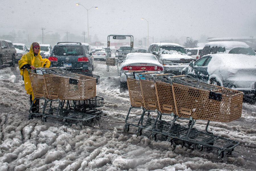
Fall snow storm, tornadoes wallop Plains
Loading...
| Sioux Falls, S.D.
A deadly storm system that buried parts of Wyoming and South Dakota in heavy, wet snow also brought powerful thunderstorms packing tornadoes to the Great Plains that caused millions of dollars in damage.
The storm dumped at least 33 inches of snow in a part of South Dakota's scenic Black Hills, National Weather Service meteorologist Eric Helgeson said Friday afternoon. Later in the day, thunderstorms rolled across the Plains, and witnesses reported seeing tornadoes in Nebraska, Iowa and South Dakota. There were no reports of deaths from any of the tornadoes.
Earlier in the day, snow was blamed for the deaths of three people who were killed in a traffic accident on snow-slicked U.S. 20 in northeast Nebraska.
Forecasters said the cold front would eventually combine with other storms to make for a wild, and probably very wet, weekend for much of the central U.S. and Southeast.
Some of the greatest damage from tornadoes seemed to be in Wayne, Neb., a town of 9,600 where witnesses said at least four homes were destroyed. Mayor Ken Chamberlain said all of the residents in town were accounted for, but the storm caused millions of dollars in damage to an area that includes businesses and the city's softball complex.
At least 15 people were hurt in Wayne, but Chamberlain said none of the injuries was considered life-threatening, Chamberlain said. Seven of the injuries stemmed from two separate automobile accidents.
In Iowa, the state's Iowa Department of Homeland Security said a mile-wide tornado touched down near the town of Cherokee, cutting a 2- to 3-mile path through farmland but missing any population centers.
Meteorologists with the National Weather Service said they were still trying to figure out exactly how many twisters touched down Friday evening from storms that also brought large hail and heavy rain.
The snow in South Dakota prompted officials in Deadwood to postpone their annual Octoberfest, including Friday night's dancing-and-singing pub crawl and Saturday's Wiener Dog Races and Beer Barrel Games.
Julie Lee said she and fellow members of her White Rose Band were accustomed to snow, just "not for the fourth of October." They had barely unloaded their instruments in the Old West casino town of Deadwood before the wet, heavy snow started falling and closed part of Interstate 90, the area's only interstate.
"Our car is like an igloo," said Lee, who sings and plays the clarinet and saxophone for her North Dakota-based polka band. "I'm glad we got everything out."
Officials were warning drivers to stay off the roads in the Black Hills and in eastern Wyoming, where reports of 5 to 10 inches of snow were common. Forecasters urged travelers to carry survival kits and to stay in their vehicles if stranded.
"I've lived in Wyoming my whole life and I've never seen it like this this early," Patricia Whitman, shift manager at the Flying J truck stop in Gillette, said in a telephone interview. She said her truck stop's parking lot was full of travelers waiting out the storm.
"I know several of the businesses nearby are completely closed because they can't even get workers into work — it's pretty nasty," she said.
The snow also snapped tree limbs that knocked out power lines in parts of the state, causing thousands of people to lose power.
By Friday night, South Dakota officials had closed I-90 from the Wyoming border to Murdo. And no travel was advised in Rapid City, where first responders were overwhelmed with calls for stuck vehicles and downed trees and power lines making some roads impassable. Police spokeswoman Tarah Heupel said snow and ice was accumulating on traffic signals, making the lights difficult to see.
Although early October snowfalls aren't unusual for the region, a storm of such magnitude happens only once every decade or two on the Plains, National Weather Service meteorologist Steve Trimarchi said.
"I couldn't say when the last time we've had one like this. It's been quite a while," Trimarchi said.
The cold front is moving slowly east and expanding south and will meet up with the remnants of Tropical Storm Karen on Saturday or Sunday, after that storm makes landfall along the Gulf Coast.
Though much of the Midwest and Southeast may get soaked, it won't be as devastating as past combination storms, such as Superstorm Sandy, said William Bunting, operations chief at the Storm Prediction Center in Norman, Okla. Sandy resulted from the merging of cold fronts and a tropical storm.
The Midwest, especially Kansas, Nebraska and Iowa, are at most risk for large thunderstorms, tornadoes and hail, "perhaps baseball-sized hail," Bunting said.
On Thursday night, a tornado that touched down damaged homes and businesses in several communities, knocked out power and toppled trees. No injuries were reported.
The storm system also blanketed Colorado's northern mountains with snow.
Associated Press writers Grant Schulte in Lincoln, Neb., Seth Borenstein in Washington, D.C., Chet Brokaw in Pierre, S.D., Steve Paulson in Denver and Bob Moen in Cheyenne, Wyo., contributed to this report.


