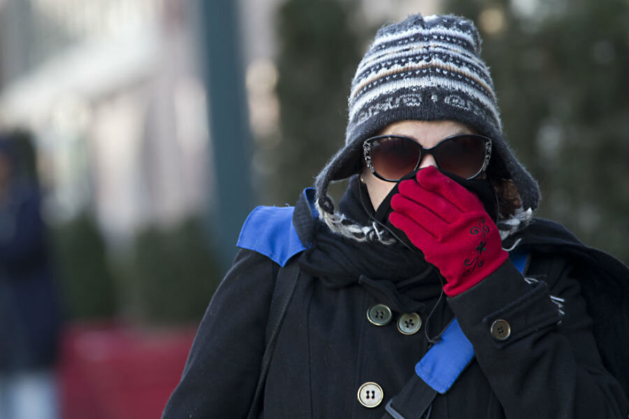
Big Chill in the Northeast: What's behind it and how to cope
Loading...
| New York
The National Weather Service says the coldest air mass of the winter may hit the Eastern U.S. this weekend.
A wind chill advisory was in effect for New York City beginning Saturday afternoon and continuing to noon Sunday. With the actual temperatures falling as low as 4 degrees below, the weather service says the city could see wind chills of 18 degrees below to 24 degrees below. Wind gusts may reach 45 mph.
The National Weather Service says:
Arctic air will be the big story across the northeastern U.S. through the weekend. An eddy of the polar vortex over Quebec, along with a reinforcing cold front, is expected to bring the coldest weather of this winter season from the Great Lakes to New England. Wind chill warnings and lake effect snow warnings are in effect for these areas, with wind chill readings dropping below -30 degrees by Saturday night. Actual temperatures will also be frigid with highs in the single digits and teens, and subzero lows across much of upstate New York and New England. It will also be quite cold from the Ohio Valley to the Mid-Atlantic region.
New York City Mayor Bill de Blasio warned New Yorkers to take "extreme precautions" over the weekend and heed cold-weather warnings. He said city workers would also bring people living on the street to shelters or hospitals.
Racing officials have canceled all races at New York's Aqueduct Racetrack because of extreme cold and high winds.
The New York Racing Association says there will be no live racing at Aqueduct on Saturday "out of an abundance of caution" for horses and jockeys. Daytime high temperatures were expected to be around 20 degrees in New York.
Racing is scheduled to resume on Sunday but officials say they will continue to monitor weather reports.
The bitter cold is expected to settle in over the next several days but temperatures are forecast to rise by Monday.
Jon Erdman of The Weather Channel explains the big chill over the Northeast and the relationship with the polar vortex:
Paradoxically, when the polar vortex is strongest, you're less likely to see cold air plunge deep into North America or Europe. By strongest, we mean the generally west-to-east flow around the vortex is stronger than average.
The easiest way to conceptualize this is in terms of a wall. A stronger polar vortex effectively helps to wall off cold Arctic air from the mid-latitudes.
This is precisely what we saw in December 2015. A stronger-than-average polar vortex centered almost directly over the North Pole helped to confine cold air to the high latitudes. December 2015 ended up being the warmest - and wettest - December on record in the U.S.
But in February 2016, the polar vortex has weakened, notes Mr. Erdman.
When this happens, lobes of the larger vortex can sweep southward toward southern Canada or northern Europe, helping to drive Arctic cold plunges into lower latitudes. In essence, the solid wall we talked about earlier has given way.
The Massachusetts Emergency Management Agency urged residents to take precautions during this period of extreme cold weather.
Stay indoors if you can. If you must go outside, dress in layers and make sure your car is equipped with cold weather gear and an emergency kit” stated Massachusetts Emergency Management Agency (MEMA) Director Kurt Schwartz. “Remember to check on your family, the elderly, or others with access and functional needs to make sure they are safe.”
Prolonged exposure to the cold can lead to serious health issues including frostbite and in extreme cases, hypothermia. Therefore, MEMA urges residents to minimize outside activities. If you must go outside, follow these safety tips:
- Dress in several layers of loose-fitting, lightweight clothing, rather than a single layer of heavy clothing. Wear a hat, mittens (rather than gloves) and sturdy waterproof boots, protecting your extremities, and cover your mouth with a scarf to protect your lungs.
- Watch for signs of frostbite and hypothermia.
- Have a well-stocked home Emergency Kit that includes a flashlight, sleeping bag or blanket, portable radio, extra batteries, a first aid kit, bottled water and non-perishable food.
- Make sure your car is properly winterized. Keep the gas tank at least half-full. Carry a Winter Emergency Car Kitincluding blankets, extra clothing, a flashlight with spare batteries, a can, waterproof matches (to melt snow for drinking water), non-perishable foods, windshields scraper, shovel, sand, towrope, and jumper cables in the trunk.
- Be a good neighbor. Check with elderly or disabled relatives and neighbors to ensure their safety.
- Limit outdoor time for your pets. Freezing temperatures are dangerous to animals as well as humans.
- Ensure you have sufficient heating fuel, as well as alternate emergency heating equipment in case you lose electricity. When utilizing alternate heating sources, such as an emergency generator, your fireplace, wood stove, or space heater, take necessary safety precautions:
- Keep a fire extinguisher handy and ensure everyone knows how to use it properly.
- Never heat your home with a gas stove or oven or charcoal barbecue grill.
- Make sure all heating devices are properly ventilated and always operate a generator outdoors and away from your home. Improper heating devices can lead to dangerous carbon monoxide (CO) buildup in the home. Make sure you test smoke alarms and carbon monoxide detectors. Carbon monoxide is an odorless, colorless gas that can cause flu-like illness or death. If you suspect carbon monoxide poisoning, call 911 immediately, get the victim to fresh air, and open windows.


