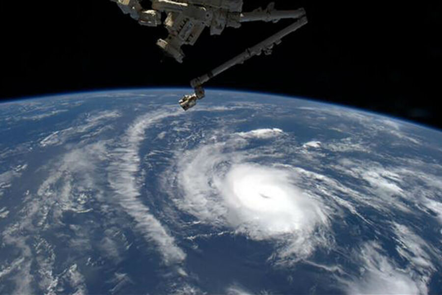
Hurricane Danny fizzles: Why are there fewer big hurricanes?
Loading...
| ATLANTA
Hurricane Danny, a small hurricane that at one point reached Category 3 status as it moved across from Africa toward the Leeward Islands, has weakened quickly and by Sunday should be reduced to tropical storm status. An unusually strong atmospheric wind shear can be seen on satellite images Saturday literally whisking the storm away.
To be sure, Danny remains a dangerous development. Slated to hit the Virgin Islands early in the week, the storm could still cause wind-and-rain damage to island interests. But its days as a hurricane are likely over as El-Nino-fueled shearing winds discombobulate its core, weakening it in the process.
“After [Friday's] nearly flawless appearance on satellite images, Danny is now showing signs of a more hostile environment,” writes Brian McNoldy, senior research associate at the University of Miami's Rosenstiel School of Marine and Atmospheric Science, on his weather blog. “The micro-hurricane is surrounded by dry air, and is entering a belt of strong vertical wind shear.”
Such hurricane-killing conditions fit a familiar pattern, notable against a national look-back at hurricane Katrina, a category 3 storm that devastated the Gulf Coast, and particularly New Orleans, nearly 10 years ago. NOAA’s Climate Prediction Center recently updated its 2015 hurricane season outlook to say there’s a 90 percent chance that the number of sizable storms will be below normal; its previous chance estimate for a below-normal storm year was 70 percent.
Save for hurricane-turned-cyclone Sandy in 2012, the US mainland has been spared any major hurricane destruction since a spate of big storms, including hurricanes Katrina, Rita, and Dennis, struck the Gulf Coast in the mid-2000s. Indeed, a 9-year “drought” in Category 3 or greater storms that reach land is unmatched by any stretch since at least 1850, according to a 2015 NASA study.
That’s not to say it’s been a dull season so far. Already, two big tropical storms – Ana and Bill – have struck the US mainland. (Ana hit South Carolina; Bill struck Texas).
But as for storms building enough brawn to be a real threat, not so much.
Unusually high atmospheric wind shear caused by a historic El Nino event in the Pacific, cooler than normal Atlantic water temperatures, air pressure differentials between the Atlantic and the East Pacific, and even dust from Saharan sand storms all play into dynamics that affect the easterly African weather waves that sometimes curl into Atlantic hurricanes.
Indeed, the same wind shear that’s dismantling Danny is likely the biggest reason for such a stretch of quiet storm years. (Remember, 2005 had 11 named storms, seven of which hit land and five of which caused major damage.) Colorado State University meteorologist Philip Klotzbach found that wind shear has been record-breaking this summer in the Caribbean, exceeding conditions present during the big El Nino year of 1997.
"As hurricanes develop from thunderstorms, they need to grow tall in the atmosphere as heat and moisture is concentrated in the middle of the storm," the Washington Post's Angela Fritz wrote last month. "If winds are too strong at the upper levels, it can tear a young storm apart, or even prevent it from developing in the first place."
But stay tuned: No matter how battered by wind shear, Danny could still pack a punch by the time it inches across the Atlantic, and – if current tracks hold – might yet threaten the US mainland after passing over the Leeward and Virgin Islands early in the week.
“I've gotten a lot of questions from south Floridians about this storm, and as of now, there is no cause for concern … just cause for attention,” writes Mr. McNoldy, on his blog.


