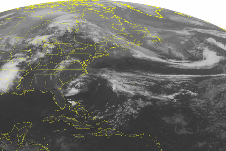
Tropical Storm Ana: First named storm of hurricane season
Loading...
| MIAMI
Early surprise Ana muscled up to a tropical storm early Saturday as it plodded toward the Carolinas, threatening to push dangerous surf and drenching rains up against the Southeast coast as it made its appearance weeks ahead of the official start of the Atlantic hurricane season.
Ana was centered at 8 a.m. EDT about 115 miles (185 kilometers) south of Wilmington, North Carolina and about 100 miles (165 kilometers) southeast of Myrtle Beach, South Carolina, according to the U.S. National Hurricane Center in Miami. The storm had top sustained winds of 60 mph (95 kph).
Ana was moving north-northwest at 5 mph (7 kph) on a forecast track expected to bring it "very near" the coasts of South and North Carolina sometime Sunday morning, .
Senior Hurricane Specialist Stacy Stewart said dangerous surf and rip tides appear to be the biggest threat posed by the Atlantic season's first tropical storm though isolated flooding in some coastal areas is also a concern. Although the season doesn't formally start until June 1, he told The Associated Press such early surprise storms are not all that unusual every few years or so.
"We had a similar situation occur twice back in 2012 when we had two early season tropical storms, Alberto and Beryl," Stewart noted of two storms that also emerged in the month of May. "That was very unusual to get two storms before the normal start of the hurricane season; one is not that unusual.
But Ana marked the earliest subtropical or tropical storm to form in the Atlantic since another storm named Anaemerged in 2003, the Hurricane Center said in an earlier tweet. The Atlantic season officially runs from June 1 to Nov. 30, a period experts consider the most likely for tropical activity in the ocean basin.
Stewart said Ana emerged from a subtropical system, meaning it initially had characteristics of both a tropical storm — which drawns energy from warm ocean waters — and a traditional storm system driven by temperature changes typical of cooler weather before the season start.
Despite Ana's early appearance, he cautioned, swimmers and surfers should stay out of the water because of rough surf and dangerous rip tides. He added people watching the surf from jetties and piers should be cautious due to waves the storm can kick up.
"The biggest danger is rough surf and rip currents. We just don't want people out there swimming in the waters. We especially don't want surfers in the rough surf. If they go under they could get dragged out to sea," Stewart added.
The center said a tropical storm warning extends from south Santee River in South Carolina to Cape Lookout, North Carolina, with 1 to 3 inches of rain expected over a wide area and up to 5 inches in some isolated spots. He also said the storm could push water 1 to 2 feet above normal height levels, causing some localized flooding.
A tropical storm watch also was in effect for Edisto Beach, South Carolina, to south of the South Santee River.
A tropical storm warning means tropical storm conditions are expected somewhere within the warning area, inAna's case within 12 to 24 hours, according to the center. A tropical storm watch means tropical storm conditions are possible in the watch area within 24 hours.


