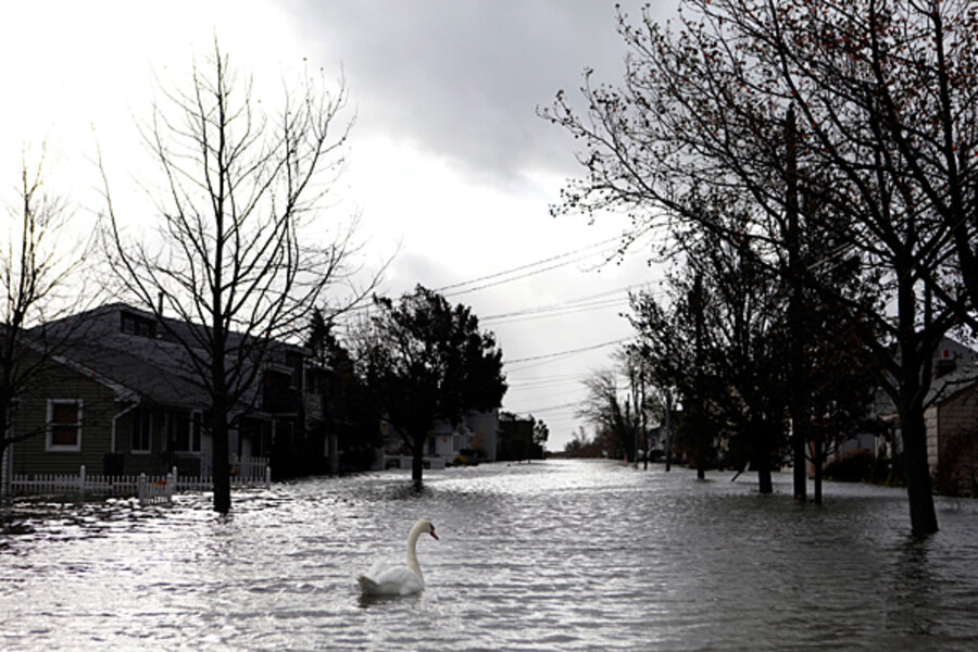
Sandy, unspent, moves toward Great Lakes. How much more rain, snow?
Loading...
The tailings of superstorm Sandy, now a post-tropical cyclone, continue to lash the Northeast and the mid-Atlantic, even as the storm on Tuesday is wreaking fresh havoc in interior states, whipping up massive waves on the Great Lakes, dropping several feet of snow in the Appalachians, and creating risk of new flooding and power outages extending into the Midwest and Canada.
As of midmorning Tuesday, Sandy’s approximate center was over western Pennsylvania, inching northwest at a leisurely 15 miles per hour. The storm is expected to make a slow turn to the north and then the northeast Tuesday night – a track that will take the slowly fading center across western New York and then into Ontario. Seen from space, the storm, which caused record storm surges in New York and New Jersey, covers nearly half the United States.
While the worst is over along the Atlantic coast, the storm could yet drop another foot of rain in isolated pockets. On Lake Michigan and Lake Huron, waves could get as tall as 35 feet. The storm’s powerful churn is creating blizzard conditions along its western flank, as cold, wet air is being drawn down into West Virginia, southwest Virginia, and Tennessee.
Meterologists are warning residents of New England that they could see thunderstorms throughout the day and into the night along the storm’s eastern flank, with a potential for localized flooding.
In the Great Lakes region, Sandy has halted shipping operations, and wave action is building in places like Michigan’s "Thumb Area" near Port Huron. Lake Huron’s low water levels, however, mean that officials aren’t overly concerned about shoreline flooding. In Chicago, officials are warning residetns and bicyclists to stay away from Lakeshore Drive, as massive waves began to crash against the breakwaters.
As Sandy came onto the US mainland in New Jersey on Monday, it caused massive flooding in Atlantic City, N.J., filled New York’s Brooklyn-Battery Tunnel with water, sank a tall ship replica of the HMS Bounty off North Carolina’s Cape Hatteras, and left at least 17 dead.
In the borough of Queens, boats rescued 25 people from a fiery conflagration that claimed 50 homes. On Tuesday morning, boat rescues were under way in the New Jersey towns of Moonachie, Little Ferry, and Carlstadt, after an upstream dam crumbled, flooding populated areas with as much as five feet of water and causing people to scurry onto their roofs.
Blinding, gale-driven snow stranded hundreds of motorists along Interstate 65 in West Virginia, forcing the National Guard to respond.
The storm continues to produce wind gusts up to 60 m.p.h., enough to knock down tree branches and power lines. Nearly 8 million people woke up Tuesday morning without power, and utility companies say it could be as many as 10 days before the lights come back on for some people. New York, the nation’s largest city, has been largely immobilized as a result of flooded subways and power outages that rocked critical electric and communications infrastructure.
So far, President Obama has declared states of emergency in five states, as well as Washington, D.C.
The dynamics of Sandy – in essence an ebbing hurricane morphed into a “super storm” as it clashed with a western cold front and Arctic air – ensure that it will continue to cause trouble for the next few days. That means a cold, wet Halloween for millions of trick-or-treaters.


