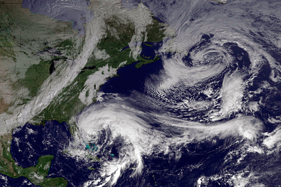
Hurricane Sandy: what to expect from North Carolina to Massachusetts to Ohio
Loading...
| New York
Hurricane Sandy is shaping up to be one major storm once it heads for land somewhere along the East Coast.
How major?
On Friday, the weather experts at the National Oceanic and Atmospheric Administration (NOAA) began to quantify what residents from North Carolina to Massachusetts to Ohio can expect starting early next week.
NOAA’s latest projections show the storm coming ashore in Delaware and then moving into southern Pennsylvania. However, the storm’s course could change.
In all likelihood Sandy, which is not expected to be a hurricane when it comes ashore, will dump a very large amount of rain. It could dump 10 inches along the coast close to the area of landfall. Inland, expect five to 10 inches of rain, NOAA says.
Rivers including the Susquehanna, Schuykill, and Potomac could spill over their banks.
“There is a widespread risk of flooding,” said Louis Uccellini, director of NOAA’s National Centers for Environmental Prediction, at a Friday press conference.
Further west in the Appalachian Mountains, all the rain will turn to snow – a lot of snow for this early in the season.
NOAA expects a foot of snow in West Virginia, but it wouldn’t be surprised to see two feet. Even eastern Ohio, where politicians are scrambling for votes, has the potential for four to eight inches of heavy snow, according to NOAA.
Some coastal communities could not only see huge amounts of rain, but also a very strong storm surge. Unlike 2011’s hurricane/tropical storm Irene, which was parallel to the shoreline, Sandy is poised to arrive perpendicular to the beaches.
“Someone will get a significant surge, but too early to say what that will be,” said James Franklin, branch chief at NOAA’s National Hurricane Center, during the press conference. “The onshore airflow will be bringing the surge in so locally it will be in excess of Irene.”
Since NOAA’s computer models have a margin of error of about 200 miles four days before a hurricane makes landfall, it is too early to say exactly where Sandy will come ashore, the weather agency says.
No matter where it meets land, a very large area will be involved, NOAA says. And tropical-force winds – near hurricane-force strength at times – can be expected from North Carolina to New England. Unlike a “normal” hurricane, where the wind fields can miss some areas, that isn’t likely to be the case with the remains of Sandy. Almost everywhere along the Northeast coast can expect gales, said NOAA.
But the winds could also be very strong as far west as Cincinnati; Louisville, Ky.; and Evansville, Ind. “We could see winds of greater than 50 miles per hour in the Ohio Valley,” Mr. Uccellini said.
Unlike most hurricanes, which move past an area in a few hours, the remains of Sandy are expected to move very slowly. Thus the winds could last for two or three days, NOAA says.
“We do expect a lot of wind damage,” said Mr. Franklin.


