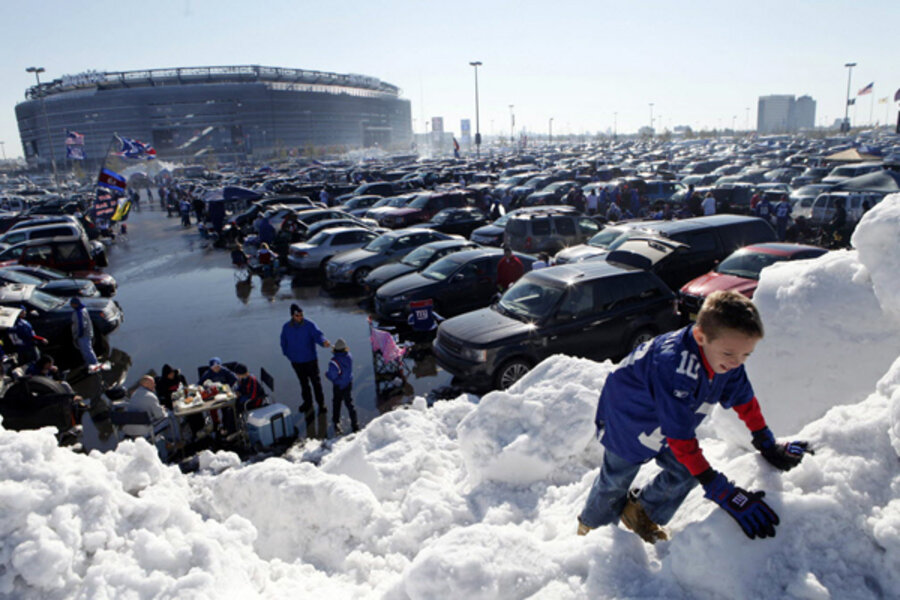
Snow on the way? Why forecasters see a big winter for much of eastern US.
Loading...
| New York
Attention residents from northern Alabama to Boston: In anticipation of winter, you might have to get the snowblower tuned up and stock up on warm clothes.
But if you live in Chicago or Minneapolis, you might not need to get the snow shovel out much this winter at all.
What’s more, farmers in west Texas, Kansas, and Nebraska might finally get a break: A painful drought could end.
Yes, fall is just under way, but America’s meteorologists are starting to focus on winter.
The winter forecast is particularly important for energy companies, which need to buy natural gas or stockpile home heating oil. The forecast also helps retailers know whether they need to buy extra items like scarves. Large cities might need to decide whether they should load up on salt to keep the roads clear. And farmers can use the forecast to plan their crops.
“I know a lot of our clients use the winter forecast for industrial and utility applications,” says James Aman, senior meteorologist at Earth Networks-WeatherBug in Germantown, Md. “But it could be helpful for emergency planners in California if the forecast were for heavy rain that might cause mudslides: They might want to prepare for it.”
Winter forecasting can be quite challenging, says Bryan Norcross, senior executive director of weather content and presentation at the Weather Channel in Atlanta. “This is very much an uncertain branch of science,” he says.
For example, to know how much rain or snow an area will receive, a meteorologist needs to predict the path of the jet stream, the river of air that crosses the nation. Last year, the jet stream was far to the north, resulting in very mild conditions in places like New York and Boston. If the jet stream dips to the south, it can result in cold weather all the way to Florida.
“The early indications are that it will be somewhere in the middle,” Mr. Norcross says. “If it’s in the middle, you kind of have a combination of enough cold air to produce winter storms that affect bigger cities.”
The main dynamic that could influence the jet stream this winter appears to be a developing El Niño, which is an unusually warm water temperature in the Pacific Ocean.
“It is not official yet, but it looks as if a weak El Niño is forming,” says Meghan Evans, a meteorologist in State College, Pa., for AccuWeather.com, which released its winter forecast on Wednesday.
AccuWeather looks at other years where the weather patterns were similar to make its forecast. Ms. Evans says other “good matches” are the winters of 2006-07, 2002-03, and 1953-54.
Using those years as a model, AccuWeather is forecasting above-normal snowfall from the southern Appalachians to southern New England. The biggest storms, it says, will take place in January and February.
“Once the snowfall starts, temperatures will be below normal through February,” Evans says.
The Great Lakes area from Michigan to the western part of New York State – known for heavy lake-effect snows – will get a lot of the white stuff between November and January, Mr. Aman forecasts.
But cities such as Chicago and Minneapolis, which normally have a lot of snow, will miss out on big storms this winter, according to AccuWeather. “The main storm track will be well south of the area,” Evans predicts. “They may get some Alberta clippers, which are quick-moving storms moving out of Alberta, Canada, but there is usually not much snow associated with them.”
The more southern track of the storms, however, is expected to bring some needed moisture to the southern Plains and west Texas, AccuWeather forecasts. This may help to alleviate a drought that caused angst for many farmers.
Then again, the AccuWeather forecast is not so good for Washington State, Oregon, parts of Wyoming, Idaho, and Montana. According to the US Drought Monitor, some places such as Pendleton, Ore., and Boise, Idaho, received only 10 percent or less of their normal August and September rainfall. Things aren’t expected to improve.
“We feel pretty confident precipitation will be below normal in the Northwest, and the drought will worsen,” Evans says. “That could extend the fire season.”
But further south, the shift in the jet stream could bring helpful rain to southern California. Last year was drier than normal in California. “It looks like southern California will get more precipitation than normal, while the northern areas will be near normal,” Evans says.
The Rocky Mountain region could start with a burst of snow – helpful to ski resorts, Evans says. AccuWeather then expects the snow will ease up before a second round of the white stuff hits the area in late February or early March.
The Southeast part of the country, meanwhile, could be a little wetter than normal. In fact, AccuWeather expects northern Gulf of Mexico areas, such as Alabama and the Florida Panhandle, to face the threat of severe thunderstorms and tornadoes into late November and early December. Temperatures might be a degree or two below normal in places like Tallahassee, Fla., and Atlanta.
Once the cold fronts start to surge south, they could be problematic for the nation’s citrus-crop areas, AccuWeather says. However, it expects most of the area to avoid a damaging freeze.


