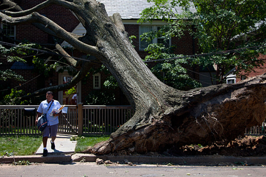
How the 'derecho' storm came to be such a surprise to the mid-Atlantic
Loading...
| New York
Weather forecasters first saw the small cluster of thunderstorms as they formed in northern Indiana on Friday afternoon.
As the system moved south, over the heat and humidity in central Indiana and Ohio, the forecasters started to realize this was not just an ordinary summer thunderstorm. There were reports of wind gusts topping 80 miles per hour. Radar showed the storms had formed into a bow shape and were racing along at 60 to 70 miles per hour. It had become a “derecho,” or big wind storm, which some meteorologists call a “land hurricane.”
This kind of weather event happens about once every five years, says Henry Margusity, a senior meteorologist with AccuWeather.com. The last one to hit the United States was in 2009, in the Plains states.
“These are not things where you look at a computer model and predict,” Mr. Margusity says. “It is a difficult kind of beast.”
Indeed, the question this time was: Where would the dangerous storm system go, and how long would it be a threat?
The National Oceanic and Atmospheric Administration’s Storm Prediction Center in Norman, Okla., had issued warnings for severe thunderstorms, but a computer model late on Friday afternoon predicted the system would move south into Kentucky and Tennessee.
Once the prediction center realized the system was moving to the southeast instead, forecasters thought it would lose energy once it passed over the Appalachian Mountains and air temperatures cooled in the evening. As a result, the prediction center considered the threat to the region to be a “moderate risk,” which is one level below “high risk.”
“In many situations, the mountains and the time of day will conspire to weaken storms,” says Greg Carbin, a warning coordination meteorologist at the prediction center. But, he adds, “That did not happen.”
Instead, once the storms cleared the mountains in West Virginia, they were almost as intense as they had been in Ohio. “This thing had a head of steam, and it was going to roll all the way to the Atlantic Ocean,” he says.
Hot, humid air from the Chesapeake Bay refueled the storms. Winds were gusting at close to 90 miles an hour, hurricane force by late evening. “If the wind were only 10 miles per hour less, the damage would be far less,” says Mr. Carbin.
In hindsight, Carbin, who was not working that evening, says the system should have been advertised as high risk for damaging winds. In addition, the prediction center should have termed it a “PDS” – that is, a particularly dangerous situation.
“If you knew ahead of time what was going to unfold, that would be the proper thing to do,” says Carbin.
Still, the region was in fact put on alert about dangerous thunderstorms. At 6:35 p.m., the prediction center issued a watch for the mid-Atlantic, including Washington, D.C.
“We said there was a high probability of significant wind until 1 a.m.,” Carbin says. “Anyone looking at the radar on the evening news, knowing the temperatures were very warm, would want to be concerned.”
However, he agrees that six hours is not enough warning time (the storms hit around midnight). With enough warning, meteorologists say, homeowners could grab loose items from outside and make sure they are in a sturdy building.
“You can’t outrun the storm,” says Margusity.
The key ingredient in this storm, which Margusity terms a “super derecho,” was very hot and humid conditions on the ground. Many locations were reporting temperatures close to 100 degrees. “The fuel was just sitting there,” he says.
Combine that hot air with a large high-pressure system in the middle of the country. In the center of the high, winds were light. But on the periphery, they were moving along at a fast pace. That’s where the thunderstorms formed. As they developed, they poked higher and higher into the atmosphere until they started to drag down cooler air from the jet stream.
“Now, we have a whole line of storms working together, driving that high-velocity air down,” explains Alex Sosnowski, a senior meteorologist at AccuWeather.com.
Can it happen again?
“They don’t happen every year,” answers Julie Gaddy, a senior meteorologist at Earth Networks in Germantown, Md. “They could, but they don’t.”
Margusity thinks the storm is one of the “top three events” of the summer.
Although the event is relatively rare, it has been studied and documented before, says Ms. Gaddy, who was out videoing lightning strikes when the storm moved in. She expects the prediction center will review its information to see if it can make a better prediction next time.
“I am sure there will be many studies and research projects,” she says.


