Snowstorm batters Southwest: Holiday travelers brace
Loading...
| New York
Call it an early white Christmas for residents from Santa Fe, N.M., to Dodge City, Kan.
Meteorologists are calling for a powerful storm to intensify through the day, dumping 6 to 12 inches of blowing, drifting snow. By tonight, travel in places like Liberal, Kan., Dalhart, Texas, and maybe even Amarillo, Texas will be difficult and dangerous.
If there is any good news about the storm, it is that weather forecasters expect it will start to lose its winter-weather characteristics as it heads east. This will make it easier for procrastinators to get to the malls before Christmas. And, it appears the storm will not cause a major disruption of air travel except perhaps some delays later on Monday in places like Dallas and Houston, which could get some thunderstorms.
“The one fortunate thing about this storm is that is moving right along,” says Tom Kines, a meteorologist at AccuWeather.com in State College, Pa. “By tomorrow it is greatly diminished as far as snow is concerned and as it heads northeast it will lose a lot of its wintery characteristics once it leaves the southern Plains.”
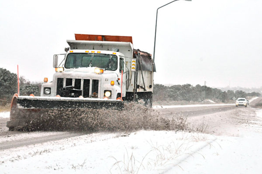
In the meantime, communities in the path of the storm are battening down. Some highways are being shut down, local airports are diverting flights, and state and local highway departments have plows ready to start clearing the snow.
According to local residents in Dalhart, Highway 87 – which connects to Raton, N.M. – has already been shut down. “All the places to stay have already been filled up,” says municipal Judge Coy Gergen in Dalhart, which is expecting about a foot of the white stuff. “We usually get one bad one a year and this looks like it.”
Preston Cooley, an assistant airplane mechanic at BCL Aviation in Dalhart says the storm has kept people from flying. “We’ve had no planes in today,” he says, noting the storm will also probably prevent him from driving to his girlfriend’s house in Colorado.
Blowing snow will be especially difficult on livestock, says Judge Gergen, observing that the area has a lot of feedlots for cattle. “If they are on grass, the only thing you can do is make sure they have feed,” says Gergen. "Get some hay out there.”
One positive aspect of the storm in the region is that it might put some moisture in the soil. That could benefit the winter wheat crop, says Gergen. “As long as the wind doesn’t just blow the snow into the ditches.”
Further to the northeast in Garden City, Kan., road crews are waiting to see how much of the forecasted 5 to 9 inches of snow actually falls. “We have aggregate ready to be spread at all the intersections,” says Matt Allen, city manager. “But, it just depends on what happens – if you have a blizzard and whiteout conditions, you can have all the equipment in the world and it just does not matter.”
Mr. Allen expects the snow to hurt retailers if they can’t have their stores open. “If you lose a day before Christmas, it’s probably a bad thing,” he says. Fortunately, merchants in Garden City, which is mainly an agricultural area, have done well the last few years because crop prices and crop yields have been good.
“Western Kansas has been a good place to be the last couple of years,” he says.
Despite the storm in the high plains of New Mexico, Oklahoma, Texas, and Kansas, the weather in the rest of the nation will be good for retailers, says Evan Gold, a senior vice president at Planalytics, a business weather forecasting firm in Berwyn, Pa.
“Fortunately, not very many major metro areas will be hit,” says Mr. Gold. “By the time the storm gets to I-95, it will be mainly a rain event.”
According to Mr. Kines of AccuWeather.com, the snow will turn to rain by midday Tuesday as it moves into Arkansas. The rain will move into the Ohio Valley and then the mid-Atlantic on Wednesday. The western part of New England may get some frozen precipitation causing some slippery roads. Unfortunately, the New England ski areas will not get any new snow, Kines says.
On Sunday, Christmas Day, Kines says a system that will form in the northern Rockies on Wednesday, could bring some snow to the lower Great Lakes and western New York. And, a system might bring some rain to the mid-Atlantic region again on Thursday night. “But, there is not a snowstorm around for anyone,” he predicts.
For procrastinating holiday shoppers, Gold from Planalytics says the weather should be pretty good through Saturday. In fact, the larger problem for retailers, he says, is that the temperature has been warmer than normal. This means retailers are stuck with parkas, warm boots, and scarves. “They will have to get pretty aggressive to move them,” he forecasts. “So consumers will probably see some pretty good bargains on the day after Christmas.”
Gold says for those in need of warm clothing it might not be a bad time to pounce. “Winter is definitely going to come, it will just be in the back half of the season.”


