First look at hurricane Irene: Thankfully, not a 'monster'
Loading...
| Raleigh, N.C.
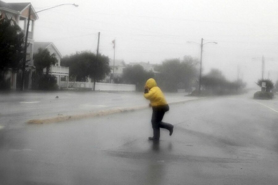
Proving that hurricane prediction is more art than science, hurricane Irene wandered rather than crashed into the North Carolina coast Saturday morning as a Category 1 hurricane, spawning localized tornadoes, swelling rivers and cutting power to 160,000 homes.
A massive storm that hit the Bahamas as a Category 3 storm weakened instead of strengthened Friday, making landfall at Cape Lookout, N.C., around 7 a.m. Saturday with sustained winds no stronger than 85 miles an hour.
The storm could gain some strength over the day, but is likely to quickly weaken again as it heads north toward more populated areas of the mid-Atlantic and New England, says Mike Biggerstaff with NOAA's Severe Storm Laboratory, who was on site in Morehead City gauging the storm.
Hurricane prep: Are you smarter than a storm tracker? Take our quiz
The storm still carries some punch, says Mr. Biggerstaff.
“The eyewall just went by us and is about 17 kilometers in altitude, and there's strong convection in the eyewall as it moved over land,” he said from Morehead City, just to the west of the hurricane core's landfall. “We'll see some very strong storms and winds for a little while before it weakens again.”
The heaviest damage so far came near the town of Columbia, N.C., near the Virginia border, where “tornadic activity” blew apart half a dozen empty mobile homes and knocked out a sewer station. North Carolina authorities reported tornado activity in three counties, with minor injuries. One death was attributed to the storm: A man in Onslow County who died from a heart attack while boarding up his home.
On the Outer Banks, Highway 12 was one of 10 roads across the state closed because of flooding and overwash from storm surges. North Carolina currently has 7,500 evacuees in 81 shelters.
But even as hurricane force winds continued to lash North Carolina, the overall sense among those in the hurricane's path was a sense of relief that the storm's landfall didn't live up to its hype.
“I feel fairly good about what we're going to have today,” says Rhett White, the town manager of Columbia, in a phone interview. “Our worst is behind us.”
Coastal areas across the mid-Atlantic remained under hurricane warnings as evacuations of over 300,000 people in New York City continued. New York City Mayor Michael Bloomberg ordered mass transit in the city to shut down at noon today in anticipation of what some had predicted, because of its size and unusual path up the coast, to be a “historic” storm.
“Our team was under the impression that the track of the storm was essentially a problem for a huge amount of people, so there was a tendency, I think, to not want to underestimate the strength of the storm,” says NOAA’s Biggerstaff. “In this case, they might have held on a little long to that feeling.”
“Mother Nature is going to do what Mother Nature does, and it doesn't always follow our predictions or expectations,” added Mr. White in Columbia, N.C. “But you have to prepare with the best information you have, and you just hope it won't be any worse than that, and you can feel good when it doesn't reach that.”
Hurricane prep: Are you smarter than a storm tracker? Take our quiz


