Mississippi River flooding: After levee blast, threat shifts to Memphis
Loading...
| Chicago
An emergency procedure intended to prevent the Mississippi and Ohio Rivers from flooding several river towns appears to be working Tuesday, as river levels have fallen more than a foot. However, water levels are rising as far south as Memphis, Tenn., where heavy rainfall could contribute to a river crest of 48 feet next Tuesday.
Late Monday, the US Army Corps of Engineers blasted a two-mile hole in a Mississippi River levee to relieve water pressure that, at its height Monday night, stood at a record-breaking 61.72 feet in Cairo, Ill. The historic river town is located at the bottommost tip of Illinois, where the Ohio and Mississippi Rivers meet.
By late Tuesday morning, the water had dropped to 60.39 feet in Cairo and had fallen by almost four feet in the area of the detonated breach, the Army Corps reported.
The levee blast allowed water to flow into the Birds Point-New Madrid Floodway in Missouri, with the water traveling at 4.1 million gallons per second to create a 200-square-mile lake. Two smaller blasts downstream are expected to take place late Tuesday and allow water to reenter the Mississippi River.
The floodway, a basin surrounded by levees built to divert floodwaters, was set up in 1933. Before this week, it had not been used since 1937, the year of a historic flood when water levels reached 59.5 feet in Cairo.
Despite the floodway’s intended purpose decades ago, its use continues to be controversial, with political leaders in Missouri saying it sacrifices 130,000 acres of rich farmland and nearly 100 homes in the southeast portion of the state. After use of the floodway was proposed last month, Missouri officials filed legal motions that worked their way through the federal court system. The US Supreme Court ultimately denied their request for an injunction Sunday.
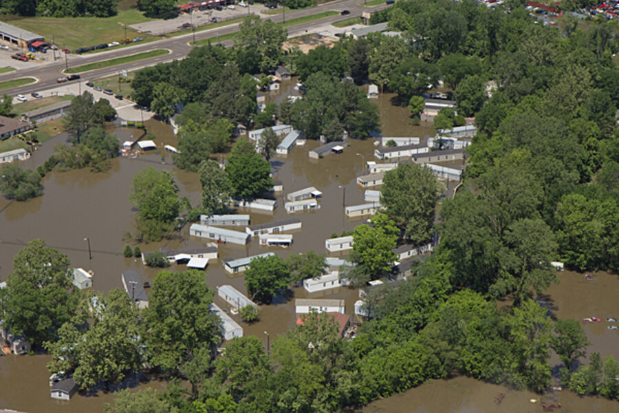
Corps officials said that if they did not use the floodway, the town of Cairo would have been washed out in 15 feet of water and that floodwaters also would have devastated the nearby town of Hickman, Ky. Before the corps took action Monday, water had been expected to rise to 63 feet in Cairo on Tuesday, splashing the top of the flood wall.
“This was a big gamble and hopefully one that paid off,” says Nicholas Pinter, a geologist at Southern Illinois University at Carbondale who is an expert on levee construction and flood-plain management. “There was a lot of talk that there was no proof [the floodway] would work. It worked. That is 100 percent clear.”
Without the delays caused by Missouri’s legal filings, Mr. Pinter says, the corps probably could have taken action earlier, which might have prevented floodwaters from topping levees 15 miles north of Cairo. There, waters flooded Olive Branch, Ill.
But even though the corps took action, it won’t have an effect on water that continues to mount in Memphis, located about 200 miles down the Mississippi River. Water levels are expected to make the crest of 48 feet on May 10, and flash flooding is already happening along local tributaries. Evacuations are under way in those areas.
Up to a half inch of heavy rainfall is expected on Tuesday in the Memphis area, the National Weather Service reported Tuesday. Water levels were at 38.6 feet Tuesday morning and are expected to reach 40 feet by Thursday evening. If the level reaches 48 feet by next week, it will be less than one inch shy of the record set in the 1937 flood.
The corps is also considering using two floodways in Louisiana – one near Morgan City and another located about 30 miles north of New Orleans.
Persistent rain, Pinter says, is driving the unprecedented level of flood threats for this time of year. Typically, flooding takes place in the late summer because the rivers build up water in different areas weeks at a time.
“It is a little bit frightening that we’ve seen such devastating flooding relatively early in the season,” he says.


