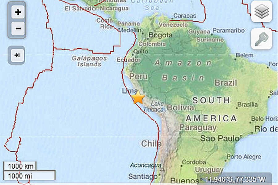
Peru earthquake: Small offshore earthquake rumbles Lima
Loading...
A small earthquake hit just off the coast of Peru early Tuesday afternoon. Early reports estimated a magnitude of 5.6, but the USGS says the earthquake was magnitude 4.6.
The earthquake shook buildings in Lima, Peru's capital city, but no injuries or damage have been reported, according to Reuters. A magnitude 4.6 earthquake can be felt, but rarely causes damage beyond clinking some glasses and knocking pictures askew. Earthquakes of this size happen tens of thousands of times per year.
The earthquake's center was about 22 miles northwest of Lima and 38 miles (61 kilometers) underground.
Peru is located on the "Ring of Fire," the belt of earthquakes and volcanoes surrounding the Pacific Ocean. All along its western coast, the South American plate is colliding with the Nazca plate, forcing the heavier ocean crust down into the Earth's mantle. The collision of the plates is like a slow-motion car wreck. They're colliding at only 3 inches per year, but that's enough to cause frequent earthquakes – and build the Andes Mountains.
The tectonically active region along the coast of South America, known to geologists as the South American arc, is more than 4,000 miles long, from just below the southern tip of Chile to just off the coast of Panama.
This earthquake was one of the deepest that Peru is likely to experience. Shallower quakes, in the top 30 miles (50 km) of the crust, are due to the crunching of the South American plate as it crumples up the Andes. Earthquakes deeper than 40 miles (70 km) are rare in Peru, and mostly limited to the northern region of the country.
Today's earthquake, located about 38 miles below the surface, was probably along the interface between the Nazca and South American plates. This zone has produced numerous magnitude 8 or larger earthquakes, many of which were followed by devastating tsunamis. The magnitude 9.5 earthquake that hit southern Chile in 1960, which remains the largest earthquake ever recorded, was one of these subduction zone-interface earthquakes.


