What if we could predict tornadoes a month out? Scientists make strides.
Loading...
Scientists have developed a fledgling ability to predict monthly tornado activity in the US up to one month in advance.
The technique, which uses existing weather-forecasting tools, is not yet ready for prime time. But in initial tests, the approach showed "statistically significant skill" in predicting regional tornado activity during most months of the year, including the peak of the spring tornado season, the researchers say.
If the approach can be honed sufficiently, eventually it could allow forecasters to identify portions of states facing the highest risk for tornadoes in an upcoming month.
In addition, the technique could help scientists explore a potential direct relationship between global warming and tornado activity. So far, such efforts have focused largely on the relationship between global warming and conditions that can spawn severe thunderstorms, which may or may not trigger tornadoes.
Though the results so far are modest, "this is exciting, because it's a hard problem," says Michael Tippett, a researcher with Columbia University's International Research Institute for Climate and Society, who lead the team.
The effort represents "an important early step" along the road to seasonal forecasts of tornado activity, says Harold Brooks, a researcher at the National Severe Storms Laboratory in Norman, Okla.
One potential audience for such forecasts would be federal and state emergency managers, Dr. Brooks suggests.
"If you were able to say: 'The second half of April is going to be really, really bad,' " it could provide extra lead time to marshal emergency supplies or ratchet up efforts to ensure more people know how to respond to tornado watches and warnings when they are issued, he explains.
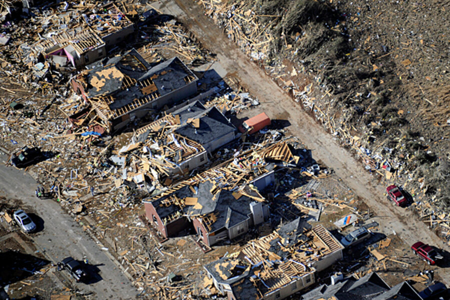
Ordinarily, Dr. Tippett spends his time developing or improving ways to make extended-range forecasts of tropical cyclones, or swings in natural climate cycles such as El Niño or the Arctic Oscillation. But that changed last April, when the US experienced its worst tornado outbreak on record. The three-day outbreak from April 25 to 28 spawned 359 tornadoes in 21 states, including four tornadoes that reached EF5, the most destructive category. The outbreak and the thunderstorms that spawned them inflicted at least $11 billion in damage and killed 322 people.
At the time, Tippett says, he noted that forecasters at the Storm Prediction Center in Norman, Okla., "had identified large regions where they thought there was going to be trouble, maybe four or five days in advance."
That implied the presence of large-scale, predictable features in the atmosphere that favor the formation of severe storms.
Researchers have applied the same general concept to produce seasonal hurricane forecasts. Tippett says it dawned on him that key atmospheric features also may encourage tornado-spawning storms to form.
The team analyzed tornado data gathered between 1979 and 2010 and identified 10 atmospheric features as potential candidates for their forecasting approach.
After some sifting, the researchers found two that appeared mostly closely tied to tornado formation. One is the intensity of rainfall in storms with strong updrafts, and the other is the amount of wind shear available to impart spin to the storm.
The team used those observed features to develop a monthly index of tornado activity. To test the index's predictive power, they replaced the index's observed values with values as forecast by the National Weather Service's latest climate-forecast model. Then the researchers compared the index-based forecast of tornado activity with the monthly averages observed over the 1979-2010 period.
For every month but September and October, the team's tornado forecast tool showed statistically significant skill at reproducing the number of tornadoes in a given month and the regions of the US where they occurred.
The team's model focuses on conditions affecting supercell thunderstorms – the vast, stand-alone thunderstorms that pop up in the Plains and Midwest in late spring and early summer. The model doesn't do as good of a job of reproducing tornado numbers in areas where the twisters are associated with storm fronts, such as the twisters that hit the South this week.
Still, other tornado researchers say the Tippett team's results are encouraging.
The approach, detailed in a recent issue of the journal Geophysical Review Letters, represents "a solid contribution" to tornado climatology, writes Grady Dixon, a tornado researcher at Mississippi State University, in an e-mail exchange. "The potential usefulness is obvious."
Indeed, over the past several months, Tippett's group – along with Brooks, researchers from Purdue University, and representatives from the National Oceanic and Atmospheric Administration's Climate Prediction Center – have been holding conversations aimed at moving toward longer-term forecasts of conditions that favor tornado formation.
One key element that is yet to be resolved: What aspect of tornado activity should be the forecast's focus?
From a public-safety standpoint, monthly tornado counts don't tell the whole story, Dr. Dixon explains. Tornadoes in late winter or early spring often affect more areas than do late-spring or summer twisters. This is because the late-winter, early-spring tornadoes tend to be embedded in fast-moving storm systems.
Thus, should a forecast focus on numbers, or expected length of tracks? Brooks notes that these issues remain to be resolved.
As for the the new model's acknowledged weak spots, "even incorrect predictions by this model can be learning opportunities for researchers as we move forward," Dixon says.


