California's sinking delta
Loading...
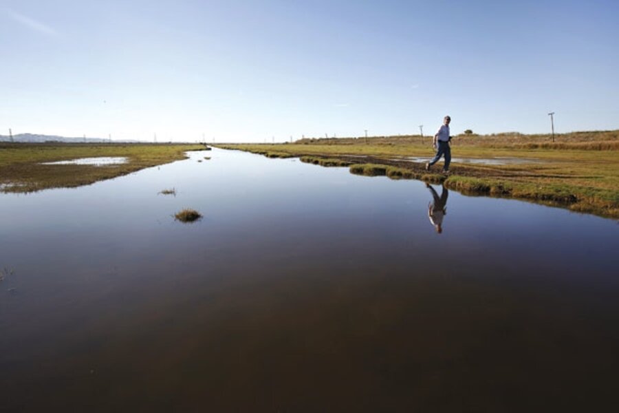
Dennis Baldocchi often drives past the ruins of his grandmother’s house on Sherman Island, in northern California’s Sacramento-San Joaquin River Delta. Flooding gutted the house when the island’s levee broke 40 years ago. Today, grass grows through the floors and chickens wander through.
To Dr. Baldocchi, the slanting hulk whispers an unsettling truth: The land that his family farmed for three generations is sinking farther below sea level each year.
Immigrants began arriving at the Sacramento River Delta 150 years ago. They drained 450,000 acres of marshy lands so that they could farm asparagus, corn, and sugar beets.
Their ingenuity fueled an economic boom, but it also triggered a slow-motion catastrophe: Draining allowed oxygen to penetrate the soil, permitting microbes to consume organic detritus that had lain undisturbed for millenniums, and to churn out carbon dioxide. As the soil deflated, the land sank as much as two inches per year.
Baldocchi, now a biogeochemist at the University of California in nearby Berkeley, spent much of his childhood on Sherman Island, pheasant hunting and helping harvest asparagus on his uncles’ farms. He didn’t appreciate the slow changes that were taking place in the land until he returned in 1999, after 22 years away.
Baldocchi motions to the road ahead. It hovers six feet above the plowed fields. The roads have sunk more slowly than surrounding fields, since blacktop slows the seepage of oxygen, which microbes need to devour peat. “When you grow up here, an inch or two per year you don’t notice,” he says. “But if you’re gone 22 years and it drops two or three feet, you get a visual sense of it.”
Land that once stood at sea level now lies as much as 20 feet below. The delta has exhaled 2 billion tons of carbon dioxide – greater than California’s total annual carbon emissions.
The sinking continues, with no end in sight. “They’ve lost already maybe [five] meters,” says Baldocchi.
A study by Steven Deverell, a hydrologist at HydroFocus in Davis, Calif., predicts that by 2050, some islands in the delta could drop another four feet.
Stepping onto a field, Baldocchi inserts a posthole digger into the ground. Three feet down, he reaches soil that has never felt a plow. He rises with a handful of brown peat that’s speckled with the woody fragments of tule reeds. “This is 4,000 years old,” he says. But within decades those aged tule stalks will evaporate back into the atmosphere, if current conditions continue.
Baldocchi’s gas-sniffing instruments on Sherman Island show that each square meter of pasture loses about 2/10ths of a gram of carbon per day. It sounds small – until you realize that across the entire delta 20,000 cubic meters of peat disappear each day.
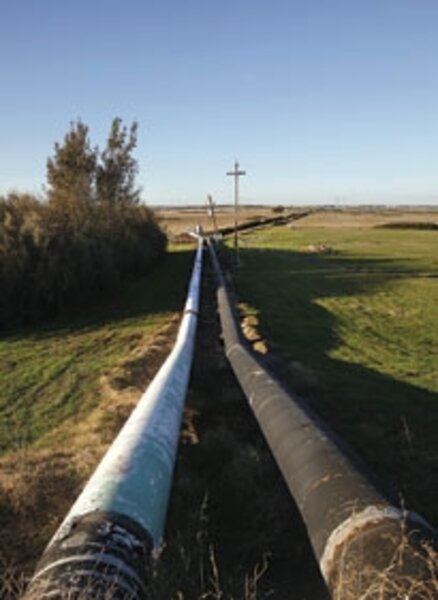
Hundreds of pumps toil to remove water that seeps through the levees, a Sisyphean task. No one knows the exact amount, but on an average day, they probably push more than 300 million gallons of water uphill over the levees, consuming fossil fuels and emitting carbon dioxide as they do.
As islands sink, the pumping costs rise. “Eventually this just gets nonsustainable,” says Jeffrey Mount, a geomorphologist at the University of California in nearby Davis. The hydraulic force pressing against levees rises twice as fast as the height of the water behind them, increasing the risk of floods.
The roads that run atop the delta’s 1,100 miles of levees often bump and sag unevenly – a sign of levee instability. The levee break that destroyed Baldocchi’s grandmother’s house in 1969 was no fluke. Delta maps show two blank spots in the jigsaw puzzle pattern of islands that were formerly occupied by islands permanently lost to levee breaks in 1938 and 1984. In the past 150 years, 144 levee breaks have occurred.
The most recent – Jones Tract, in 2004 – illustrates a danger that worries people throughout California. The delta supplies much of the state’s fresh water. But when Jones Tract flooded, it “swallowed” enough water to reverse the flow of the delta, sucking in salt water from San Francisco Bay and tainting the delta’s fresh water. The harvesting of fresh water was halted for 10 days.
In a worst-case scenario, levee failures during a storm could cause many islands to collapse at once, and the delta could “gulp” in enough salt water to shut down freshwater supplies to 20 million Californians for months.
Ongoing subsidence worsens the risk. “The more volume you have below sea level, the more [saline] water can flow onto those islands,” says Dr. Deverell. “That’s one of the driving concerns.”
Subsidence is not just a California problem. Wetland drainage has caused some parts of Florida to deflate by three feet or more. And New Orleans could not have been devastated to the same degree by hurricane Katrina in 2005 were it not for 150 years of drainage that caused parts of it to sink as much as 20 feet.
In many instances, the problem has been papered over by a montage of historic myopia, denial, and mythology, say some experts. Consider the granddaddy of cases, the Netherlands.
“God made the world, but the Dutch made the Netherlands” is a saying that evokes images of Dutch farmers heroically reclaiming land from the sea. But the commonly accepted account contains as much fable as fact, says Robert Hoeksema, a professor of engineering at Calvin College in Grand Rapids, Mich.
A thousand years ago, the Netherlands stood above sea level. It was the Dutch themselves who lowered their country into the ocean. “There is this sense that they won land from the sea,” says Dr. Hoeksema, “whereas, in fact, they’re just reclaiming land that they had first lost to the sea.”
Guus Borger, a Dutch historian at the University of Amsterdam, helped unearth this truth. He discovered 16th-century government documents indicating that low-lying areas were once devoted to farming wheat, a crop that would require lands much higher than these areas are today. That revelation led to a series of discoveries, and to a new account of how the Dutch created the modern Netherlands.
Before settlement, the country comprised an expanse of dome-shaped peat bogs rising above sea level. Around 1200, farmers dug channels to drain the domes, and the land sank, setting off a centuries-long race between technology and water. As sinking land and higher water tables threatened crops, the Dutch found better ways to drain the land – sluices, followed by dikes and windmill-powered pumps – and this lowered the water table further, enabling oxygen and microbes to penetrate deeper, devour more peat, and deflate additional land.
Today’s Netherlands lies up to 20 feet below sea level and gushes millions of tons of peat-derived carbon into the air each year.
Back in California, a patch of lush green sits in the middle of Twitchell Island – 15 acres of restored wetlands bristling with seven-foot tule and cattails. Robin Miller and Roger Fujii of the US Geological Survey in Sacramento hope to use the same plants that built the delta’s islands over thousands of years to build it once again.
This experimental plot, started in 1997, has packed away an inch and a half of organic detritus per year. “It surprises even us,” says Dr. Miller. “You could bring an island as deeply ... subsided as Twitchell up to tidal range in 100 years if you wanted to.” In a similar experiment on Sherman Island, rice is being farmed on flooded fields to accumulate carbon.
Even if a levee breaks after just 20 years, such strategies would reduce the volume of water “gulped” by the island, and therefore reduce the chance of catastrophe.
But scientists looking for solutions face an uphill battle. California’s financial crisis has prevented enlarging projects such as Miller’s experimental plot. Government proposals have generally favored strategies that route fresh water around the delta to protect it from the “big gulp” rather than addressing subsidence itself. And California makes money off the delta as it stands now, by leasing islands to farmers.
But Baldocchi expects that life on the delta will change one way or another. “It just gets to the point,” he says, “that you can’t continue the same as you’ve done [simply] because it’s romantic and it’s a nice lifestyle.”
Editor’s note: For more articles about the environment, see the Monitor’s main environment page, which offers information on many environment topics. Also, check out our Bright Green blog archive and our RSS feed.


